The rise of Open Data
From all the current buzz words “big data” is probably the “buzziest”.
According to Wikipedia this is the description: Open data is the idea that certain data should be freely available to everyone to use and republish as they wish, without restrictions from copyright, patents or other mechanisms of control.
As a “data lover” I feel this is a great idea. All those data that is collected worldwide could enable us to combine different sources and get valuable results out of it. Just an example could be to combine disease statistics with pollution, weather, … and many other sources to check if all those things influence each other. And maybe even find cures for certain diseases if the cause of them could be detected.
But we don’t have to jump that far immediately, I’m certainly not clever enough to do that :-)
Just let me start with giving some open data examples.
Google Public Data Explorer
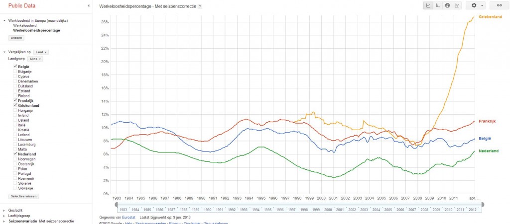
Google must be one of the worlds biggest data collectors. And as they found a long list of open data, they decided to build some tools to analyse those. You can freely play with different sources and build the graphs yourself. This is just one example with unemployment statistics, but there is a lot more available:

Obama administration
In the begining of May the Obama administration announced an initiative to open some of its databases in health, energy, education, public safety, finance, and global development.
Public transport
In Belgium the first good app to plan your train trip was made by a student: iRail. He could do that because the data he needed for this was openly available and triggered the train operator to publish a good “official” app. I found some sources of open data related to public transport, but also other interesting discussions and sites which could be used in this domain:
- http://www.gtfs-data-exchange.com/
- Eg all stops and lines from De Lijn (Belgium): http://www.gtfs-data-exchange.com/agency/de-lijn/
- http://data.gov.uk/dataset/nptdr
- https://code.google.com/p/googletransitdatafeed/wiki/PublicFeeds
- London Underground: http://www.tfl.gov.uk/businessandpartners/syndication/
- Mapped public transport points: http://wiki.openstreetmap.org/wiki/Public_transport
- http://tlc.howstuffworks.com/family/open-data-brings-public-transportation-in-the-21st-century.htm
- http://www.shareable.net/blog/how-public-is-your-transport
Kortrijk City
Closer to (my) home there is an other interesting open data initiative. The city of Kortrijk is opening some of it’s databases to allow third parties to use these in their developments. In the first stage they are opening the data about parking. In the future live feeds will be added coming from sensors in every parking spot so apps can be build which show the available places.